Timetable information
Menu
Network maps

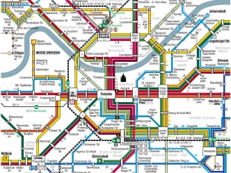
We serve almost every corner of the city. Our network maps provide an overview of all tram, bus, hillside railway and ferry connections.
Engineering works network map (valid from July 13, 2026)
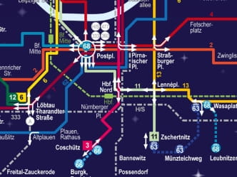
Every now and then, our trams and buses have to be diverted from their normal routes due to large engineering projects.
- Engineering works network map for Dresden downtown (German only) (JPG | 0.87 MB)
- Engineering works network map for Dresden downtown (German only) (PDF | 0.72 MB)
- Engineering works network map for Dresden (German only) (JPG | 2.30 MB)
- Engineering works network map for Dresden (German only) (PDF | 0.67 MB)
GuteNachtLinie network – roughly 1–4 a.m. (valid from July 13, 2026)
Whether you are on your way to work or setting off for a party, our GuteNachtLinie routes will take you safe and sound to your destination and back, deep into the night.
Engineering works network map for disabled people (valid since February 20, 2026)
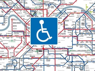
As well as a network map with information on accessibility at DVB stops, we provide detailed information on how to use local public transport in Dresden. This information brochure has been specially developed for wheelchair users in cooperation with Landesarbeitsgemeinschaft Selbsthilfe Sachsen e.V.
MOBIpoints in Dresden
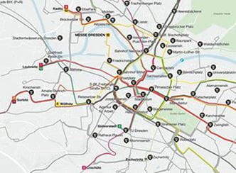
Easily switch between train, bus, MOBIbike or MOBIcar at a MOBIpoint. These are always located very close to a tram or bus stop.
There are now more than 60 MOBIpoints throughout the city – and the number is constantly growing. You can find all information about our MOBI services here.